
What's at stake?
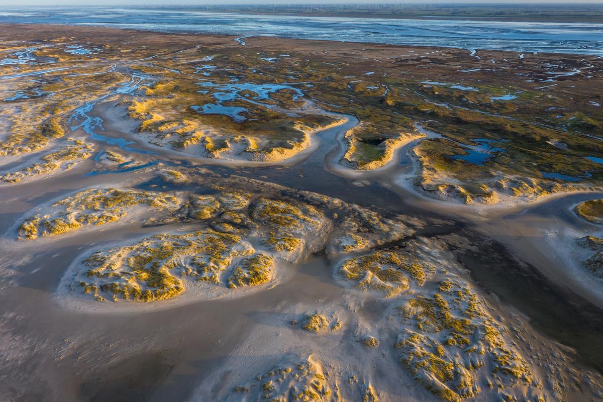
The largest tidal flat system on Earth, this UNESCO World Heritage Site stretches nearly 11,500 km2 across Denmark, Germany and the Netherlands, where natural processes still unfold largely undisturbed. Its islands, tidal flats, salt marshes and dunes host thousands of plant and animal species and support up to 10 to 12 million migratory birds each year, giving the site global significance.
Communities involved
High school students and local politicians with a focus on inclusive public engagement
Science plan summary
Main scientific question: What are the spatial and seasonal patterns of fish biodiversity (threatened, invasive, elasmobranchs), and how does eDNA compare with and complement conventional monitoring?
Localities sampled (5 sites, 4 areas named): Vidå sluice (Denmark); near the seed mussel culture (Schleswig-Holstein); Hamburg boat landing, or up to five points at Scharhörn and Neuwerk; NIOZ Jetty, Texel (Netherlands)
Why there: Different sediment types and brackish water, each near existing monitoring stations (such as the Texel fyke net) for comparison with conventional data
Sampling dates: Every 3–4 months; first rounds 21–25 Sep and 30 Nov–4 Dec 2026, then set by research vessel availability
Why then: Lampreys, sea trout, dogfish and rays use the Wadden Sea only at certain life stages. The ross worm, European lobster and some non-native species have pelagic larvae before settling, so sampling across the year lets them compare eDNA detection of larvae and adults.
About our site
The Wadden Sea World Heritage is the largest tidal flat system in the world, where natural processes proceed largely undisturbed. It encompasses almost the entire Wadden Sea in Denmark, Germany and the Netherlands: an area of nearly 11,500 square kilometres along a coastal strip of about 500 kilometres.
The Wadden Sea is a place where ebb and flow, sea and wind shape the coastline. It has islands, tidal flats, salt marshes and dunes for thousands of species of plants and animals. The site’s global significance also lies in supporting millions of migratory birds, with up to 10–12 million passing through annually.
“eDNA Expeditions will help close key gaps in species detection, distribution, and responses to climate change, ultimately improving fish community monitoring and management in the Wadden Sea.”
What we plan to achieve
Through eDNA expeditions, we aim to strengthen monitoring and management of fish communities in the Wadden Sea by addressing key gaps in species detection, distribution, and responses to climate change. Specifically, we seek to detect and map the presence of red-listed fish species, including houting, river and sea lamprey, sea trout, European eel, twaite shad, lesser spotted dogfish, thornback ray, and other shark and ray species, while improving the identification of elusive species that are often missed by conventional monitoring. By aligning sampling with seasonal life cycles, such as differing spawning periods, we aim to increase detection accuracy for hard-to-monitor species.
In the face of climate change, we also aim to enhance understanding of shifts in fish community composition, using eDNA to complement and overcome limitations of traditional monitoring techniques. Targeted efforts will focus on known species spatial hotspots that have been underrepresented in previous surveys, such as houting habitats in southern Denmark. In addition, eDNA will support early detection of species of conservation concern and newly introduced invasive species.
Overall, this work will contribute to more comprehensive, coordinated trilateral monitoring and help close critical knowledge gaps to inform effective management.